

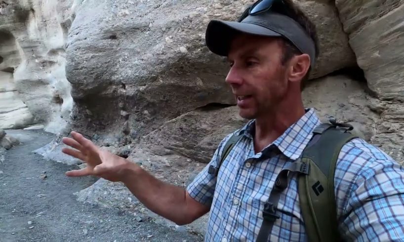
Journey through the tight, sinuous drainages of Mosaic Canyon and Stretched Pebble Canyon in Death Valley National Park with geology professor Shawn Willsey. Learn how the fantastic rocks of Mosaic Canyon formed, check out a classic normal fault, and investigate how some odd rocks are related to Snowball Earth, a period of near to total global glaciation during the Proterozoic Eon.
*Note: this is a compilation of three 2020 videos that were launched when my YT channel was just getting started. These videos are reposted here for the numerous subscribers who likely missed them.
Support these videos! You can ensure these videos continue by providing support (travel logistics, content creation, etc.) Send support via:
PayPal: https://www.paypal.com/donate/?hosted_button_id=EWUSLG3GBS5W8
or Venmo @Shawn-Willsey (be sure to put two L’s in last name)
or a good ol’ fashioned check to this address:
Shawn Willsey
College of Southern Idaho
315 Falls Avenue
Twin Falls, ID 83303
source


![Crazy, Near Death, and WTF Moments [Pt. 4] | Video Compilation 2024 | Fail Department](https://www.theviralist.com/wp-content/uploads/2024/04/Crazy-Near-Death-and-WTF-Moments-Pt-4-Video-300x200.jpg)
You can support my field videos by going here. Thanks! https://www.paypal.com/donate/?hosted_button_id=EWUSLG3GBS5W8
Great video, Shawn. Mosaic canyon is one of my favorite spots in DV. Have been several times and always wondered about the geologic story behind it.
I hope you had a great Thanksgiving. I, and I'm sure all your viewers, are thankful for what you do. Be safe and be well.
Just want to say how much I enjoy and learn from your videos. I've been fascinated with rocks and geology since I was a kid but made my career in another field. Your presentations, so clear and accessible for a lay person, have answered so many of my questions and taught me a boatload. The channel is one of my best subscriptions.
Another awesome locale and story. When I saw the Noonday Dolomite early in the video I was hoping you’d also get into the Kingston Peak Diamictite and mention snowball earth, and you did not disappoint.
One interesting thing to mention regarding the Noonday dolomite, however, is that it represents a classic example of a Snowball Earth terminal “cap carbonate”, which is a layer of carbonate found all around the world that “caps” or rests on top of each snowball earth episode’s last glacial deposits. The reason they form and their peculiarities are fascinating—the idea is that preceding each snowball earth event, carbon dioxide levels collapsed, and the thick ice sheets covered the world either completely, or at least to near-equatorial, sub-30° latitude levels, including thick amounts of sea ice. World sea levels dropped precipitously, far, far more than the 100m or so associated with our last glacial maximum, due to the amount of ice and water locked up therein. Volcanism around the world, including submarine volcanism at arcs and spreading ridges, was covered by this ice. Prior to the Cambrian explosion (and of course humans and their exploitation of fossil fuels), volcanism was the major source of carbon dioxide. These volcanoes continued to pump out carbon dioxide, and it gradually built up in the atmosphere. Because of the ice sheets ubiquity and thickness, continental weathering, sediment input, and global weather patterns would have been essentially shut down at the height of the snowball earth, and the atmospheric CO2 reservoir separated from the ocean. Freshwater melt from the warm base of congenital glaciers meeting the sea (the weight of thick continental glaciers alone is thought to generate heat at their bases) seeped into the oceans with a minimum of sediment bedload. As a result, the oceans became severely stratified, with the top 800m or so consisting of freshwater, floating on denser salt water.
As the atmospheric CO2, with no way to cycle back into the ocean, due to a lack of weather patterns caused by the homogenous ice cover and lack of available moisture, continued to collect in the atmosphere, the greenhouse effect started to become very pronounced, causing extremely rapid deglaciation, and along with it, rapid weathering of the continents, overturn of the stratified ocean, massive sediment influx (including dissolved calcium, magnesium, and other salts), and extremely severe weather patterns, and a drawdown of atmospheric CO2 surplus in the form of carbonic acid from the resulting storms, washed into the global ocean, which would have rapidly flooded the continents once again after deglaciation. All of these things created the perfect conditions for the rapid deposition of carbonates on top of the last snowball-era glacial deposits, the cap carbonates.
And the wild weather patterns and peculiarities of the situation result in some very characteristic depositional features in the carbonates, including giant amplitude wave ripples from storms that were more severe than we have ever known. There are also microbial structures associated with them, and the end-snowball conditions of high levels of CO2 and nutrient influx from weathering during initial deglaciation would have been a boon to surviving Cyanobacteria, who found virgin habitat with little competition in the shallowly-flooded, nutrient-rich warm seas of the post snowball world.
So that is the fantastic and interesting story behind cap carbonates, like the Noonday dolomite. These are found worldwide directly above nearly every last snowball glacial deposit, for each snowball event, and are considered diagnostic as to whether a specific record of glaciation was “snowball” in its extent, because cap carbonates are not associated with the other more regional glaciations of the Precambrian and Paleozoic.
Regarding the cemented debris flows…they are truly stunning. I’ve read that in some conditions they can become cemented like that I just a few years after deposition, and at most it takes only 10-20 years. Crazy. It makes me wonder what paleo debris flows in the geologic record are a result of such continual scour and fill processes, cross cutting from different channel directions and filling with slightly differently-sourced clasts. I can’t personally think of a paleo deposit like this. Perhaps none of them last long enough to be preserved, although an extensional environment, of such low elevation, and relative proximity to the ocean could easily become inundated with epicontinental/pericontinental seas…
What I don’t understand at all are those vertical beds. First of all, debris flows rarely show bedding of any kind. Secondly, I don’t understand how that bed could become so tilted as a single mass and then have a perfectly smooth contact with the surround rock. It’s one thing if a big chunk of rock falls off and turns 90°, but such a giant boulder doesn’t remain contiguous with the rest of the outcrop. Have the interstitial spaces been subsequently filled with additional debris flows/flood deposits that I just didn’t notice as lacking the (sub)vertical bedding? Because to me it looked like the bedding went all the way to the contacts on either side. Truly confounding. When I first saw it my thought was that the whole block underwent rotation, with the dolomite, due to listric fault movement. But if that were the case it would have to be much older than it probably is. Still don’t understand where the bedding comes from, unless it was just a collection of several more minor flood deposits. It looks very different from the chaotic rubble of the debris flows shown earlier. Glazner’s Geology Underfoot guide also says they were moved as coherent blocks during flooding events. I didn’t notice whether the dolomite had original bedding, will have to watch again. And again, I wasn’t able to make out if the “gaps” that would have been created by such megabreccia lodged in an irregular slot canyon, which should have then be filled later by sub-horizontal flood and debris flow deposits.
Again, great video, iconic outcrop, and thanks for taking the walk to the Kingston Peak snowball earth diamictite!
So at ~3:44 in the video no one saw what to me looks like a giant Mole face?
They are really excellent examples, the layers of flows full of interesting materials in Mosaic canyon. Beautiful. As well as the diamictite (new word). Love these! ❤️
Amazing landscape, thanks for sharing.
❤️❤️❤️❤️
Love your channel
So wait a moment , what your saying is the washing out actually adds to the debris of the canyon ? Kinda makes the term washout irrelevent . If any one knew how water behaves it it more or less has a covalent bond that wants to flow , not bog down scouring . Floats around objects , except for the initial rush of water carrying the finer debris has a potentiaal for erosion . But as for water itself does not erode unless highly acidic . Have a nice day !
Really nice work, excellent.
Another really fascinating video again. Thanks Shawn.
Why did they put gravel on the bottom?
Very nice find! Thanks for sharing this with fellow rock hounds.
Were you just there? I heard all the roads were destroyed by flash floods.
Fascinating and nicely presented.
GREAT VIDEO" Thanks" 4 Posting!
I used to go to Death Valley in the 1970s quite a bit. Interesting place. What is remarkable is that the valley floor keeps sinking to keep up with the sediments that get washed off into it. So it doesn't fill up with sediments. Devil's Golf Course is a few thousand meters of salt from years of salt deposition and it sinks and if I recall is several thousands of feet deep.
Very interesting again. Thanks for posting.
Love your vids. I live in geological boring Louisiana and ypur vids show me what I'm missing. Hope you do one on Florissant Colorado Leaf and trees fossils and the extinct volcanos there.
Cool
well done on the 10K sir , i learn allot from your vids , thanks
Very interesting! Thanks for putting these stories together.
It just struck me that now would probably be indeed the best time to visit Death Valley
Great video! I would like to hear someone put our "Global warming event" into a perspective history of Earths climate over 4600 million years. LIPs, Celestial events, when oxygen was a poisonous gas and we just hit 8 billion people on earth. Thanks for posting!!
The creek behind my childhood house has clumps of what I thought was concrete with creek gravel from someone upstream but now I know it isn't. I've seen this type of stone was up after storms along the coast of North Carolina where I lived for 30 years which locals call "reef stone" or something else I've forgotten but I collected a bunch of it and made a walkway and a dry stone wall meaning no cement which black widow spiders seemed to love.
Well done on reaching 10 K. 22/12/22
Sir, this one as well your previously posted movies have such a beautifull narrative. Storytelling about rocks. Amazing.
👏👏🙏🏼
Much love to everyone and their families from Quartzsite Arizona USA currently!🤠🌻